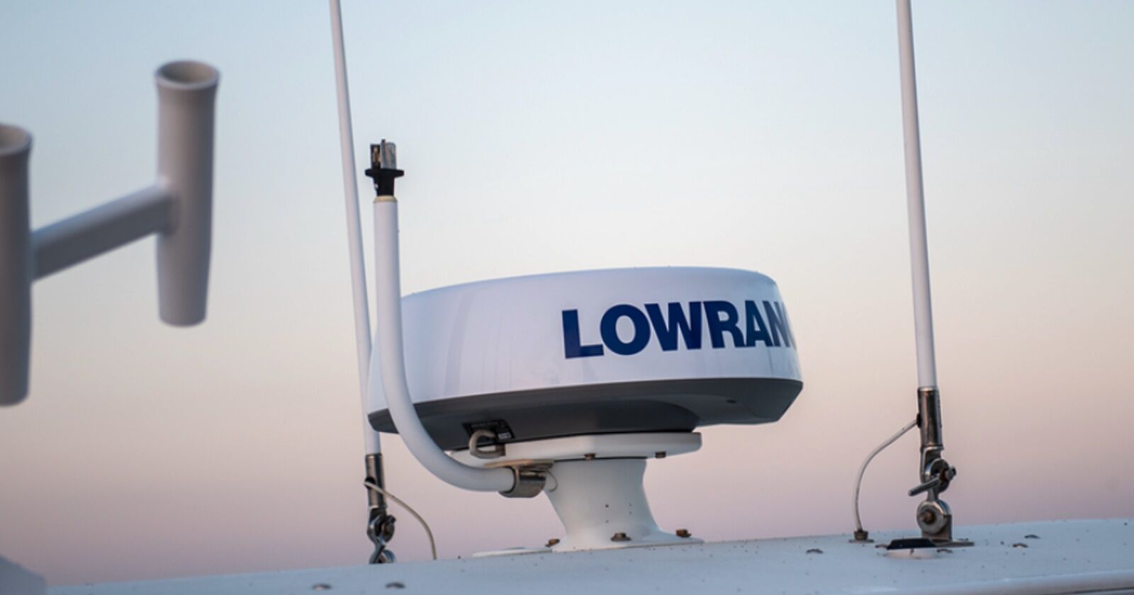
Radar Love: We’ve Got a Wave in the Air
It started off as a beautiful sunny morning fishing for coho that August long weekend way back in 1988. I had been invited by my boss at the time, Dave Johnston of The Fishin’ Hole, to join him and his family on their summer vacation at Boza Campground at Telegraph Cove on Vancouver Island.
We had had an excellent 3 days of fishing, and this was to be our last day together fishing for coho.
We were fishing out beyond Malcolm Island and had caught a few keepers when I noticed way off in the distance that the fog was starting to roll in. Dave said that it would take a while before we had to worry about it—famous last words. The bite was on, and we were going to stick it out.
The next thing I saw was two orcas surfacing about 300 yards away. They went below and resurfaced closer to us, then down once more, and back up within 20 yards. I told Dave to cut the motor, and next thing we saw was the dorsal fin rising out of the water right beside our boat—we could reach out and touch the fins if we wanted to. They just kept on rolling through, like the fog had just done. We were now fully socked in, with 6 miles to get back to Boza Cove.
All we had was an early liquid quartz display for a sonar—no GPS at that time. We didn’t even have a compass onboard, let alone a radar display. We were in a pickle! It took us 3 hours to go the 6 miles back to the marina in the fog. All we did was keep the slightly brighter patch of sky to the left side of our bow as we headed west, knowing that it was around 11:00 a.m. when we began the journey. It was very slow going when suddenly we heard a blast from a cargo ship in the area as it was passing through the Johnston Strait. We were so scared as we headed back, and swore that we would never again go out without being prepared for the weather. A very good lesson learned!
Over the last 3 decades, there has been a big evolution in consumer-based marine electronics, including sonar, GPS mapping, and radar. The original radar domes used a radar pulse signal similar to microwaves, so you had to be careful that the radar was mounted higher on the boat with no possibility of someone walking in front of it. You could actually cook a hotdog if it was suspended in front of the radar! Beginning 12 years ago, radar domes release a digital broadband signal, which has much safer emissions.
If you are considering the purchase of a radar dome for your boat, there are a few things to think about. You want to be able to utilize all its features, so read on. This article looks specifically at Navico systems as I’m the Warranty & Operations Manager for Navico Canada. Though individual feature names will be different with other manufacturers, most concepts are similar.
Marine Radar Installation
When installing a radar system, you will need to mount it on the highest point of your boat, either on a radar arch or a raised platform base that elevates it from the roof of the boat’s cabin. The height of this platform will be dictated by the amount of roof in front of and behind the dome’s location.
Most marine radars release a radar beam angle of 25°, which means 12.5° below the horizontal axis and 12.5° above the same axis. If you are using your radar mainly when you are cruising, you will want to make sure your radar is level at that point, and the same goes for if you plan to use it while almost on step. Your bow will be more raised, so you may want to install wedges under the base of the pedestal to get the correct tilt. Please refer to the manufacturer’s installation manual or have it professionally installed.
Power for Marine Radar
When installing the radar, you will need to make sure that you wire the power cable to a separate power slot on the fuse panel. Do not tie it in with any other device on the same circuit—radars are power hungry! Also make sure that you tie the yellow wake up wire with the red wire, otherwise the radar will not power up at all.
Networking a Marine Radar
All of Navico’s radars—such as Simrad and Lowrance Halo 20, Halo 20+, and Halo 24—have yellow ethernet coming out of the white radar cable. They might have an RJ45 ethernet plug that plugs into an adaptor that then has the yellow marine-grade ethernet end on it. This will then plug into the yellow ethernet port on the backside of the display, or it will plug into an ethernet expansion Port (NEP-2) which will allow you to network it to multiple displays that have the yellow port.
*Remember that ethernet is for image-based data such as sonar, mapping, and radar. It does not share engine data, GPS data, or anything that would normally be shared via NMEA 2000.
Radar Overlay
This feature has been available for a few years now, and it allows the user to overlay the radar image right on top of your chart map. This takes out all the guesswork of trying to interpret the radar image, because your larger red radar images will line up over land masses such as islands and peninsulas— even floating navigational markers that show up on your map should line up with the radar overlay. But none of this will happen without having a digital compass added to your NMEA 2000 network. Without the compass you cannot use this feature. Remember this when you go to buy your first radar.
What is MARPA Targeting (Mini-Automatic Radar Plotting Aid)?
Radars have evolved over the years from having the ability to see targets 18 to 24 nautical miles away to where they now see up to 48 miles. On the Halo 20+ and Halo 24, you also have the ability to track up to 10 targets. This is called MARPA Targeting (Mini-Automatic Radar Plotting Aid).
Targets must be selected manually, but then are tracked automatically, including range, bearing, target speed, target direction, and closest point of approach (CPA). It is essential that you have a heading sensor (compass) tied into your NMEA 2000 network.
Probably the coolest feature on the Halo20+ and the Halo 24 is VelocityTrack. When this is enabled, it will display moving targets with a different color than your main radar image color. Let’s say targets that are coming at you will display in yellow, while targets that are going away from your will display in blue. You do have palette choices to pick a different color combination if you want to. You will find that this is a very useful feature.
Birds Feature—Spotting Feeding Birds with Radar
The BIRDS feature (unique to Navico) has been available the last few years, but was mainly offered on the Open Array-type radars generally selling for $4,000 US and more. But now this feature is offered on the Halo 20+ and Halo 24. What does it do? It will display flocks of marine birds that are active in the air overtop of bait balls that have surfaced while being pushed up by salmon or other gamefish species as well as seals and whales. You can see flocks of birds for up to 5 miles or so. This can be very helpful if searching for actively feeding salmon. Watch this👇.
Radar Weather Feature
In this mode, the radar settings are optimized for the best detection and presentation of rain clutter. Image update rate is slowed, and the color depth is increased. This is very handy to see when weather fronts are moving in on your location.
After Installing Your Boat’s Radar
Now that you have your radar installed and running, I strongly suggest that you practice with it in broad, clear daylight. Practice zooming in and out your radar by changing the scale of view. Start the Overlay Radar feature and get used to seeing what large, medium, and small vessels look like, as well as navigational cans that are anchored. The more you can see what they look like in daylight, the more confidence you will have when they show up on your screen while in the fog or when you are coming back to the marina in the dark. Also try approaching a known target such as a navigational can and see how close you can get to the can while you see the image on your radar before it disappears from the center of your screen. This will help you know how close you can see targets if you are ever traveling at night or caught in the fog. The Halo 20+ and the Halo 24 can rotate up to 60 rpm, which will update the screen at a much higher rate, making it look like a live image instead of the slower, sweeping standard radar image.
Remember that practice makes perfect. It will keep you and your mates alive if you are ever caught in a situation that suddenly presents itself. There are great reference videos online, on both the Simrad and Lowrance YouTube Channels. Radars start selling at around $2,000 CND and up, but they are worth every penny for the safety assurance they offer. Remember to fish safely the next time you are out on the water. Good luck!
Radar Comparaison Table
This article appeared in Island Fisherman magazine. Never miss another issue—subscribe today!
2 Comments
Leave A Comment
Visit the Store
$34.99
$34.99
Featured Catch
Joel Unickow halibut (Photo: Rob Frawley Lucky Strike Sportfishing Tofino)

I do not have RADAR on my vessel but have installed an AIS Transmitter (NAIS 500) which reacts or displays on my LOWRANCE GPS system. Are you saying in this article that (Radar)it will not display? This past year I have noted that there are a large number of recreational fishing boats now using AIS transmitters.
Having had a similar frightening experience to yours in fog my next addition/acquisition is Radar to compliment – I would appreciate your input.
Great article 👍