According to a recent Global News article, Prime Minister Justin Trudeau announced that if he wins re-election, “…one-fourth of [Canada’s] oceans will be given protected status by 2025 under a re-elected Liberal government.”
While everyone likes the idea of protecting the environment, disclosure to the general public of exactly what this means and how that would happen, has been limited.
What we do know is that in 2019, the DFO under Jonathan Wilkinson (Lib) implemented fishing closures to “protect the habitat of SRKW (Southern Resident Killer Whales)” and later, the DFO enacted more closures to help the Fraser River Chinook as a “Species at Risk.” But what is the DFO talking about when they say “protective status?” They are talking about increasing areas restricted to recreational fishing.
Imagine Barkley Sound, Nootka Sound, Johnstone Strait, The Strait of Georgia, and the Juan De Fuca Strait all being closed to sport fishing because they are designated as (MPAs) Marine Protected Areas.
What is a Marine Protected Area (MPA)?
On the DFO website, you’ll find 4 classifications of recreational restricted fishing areas:
- Fishing in parks
- Glass sponge reefs
- Marine protected areas
- Rockfish conservation areas
The DFO defines an MPA as “… part of the ocean that is legally protected and managed to achieve the long-term conservation of nature.”
What is an Area of Interest (AOI)?
The first step in establishing an MPA is a designation as an Area of Interest (AOI); an example is Race Rocks, 17 km southwest of Victoria, BC. Historically, and in accordance with the Oceans Act of 1996, the process of establishing an MPA begins when a Governor in Council (GIC) regulation is enacted. Going back further, the Constitution Act, 1867 states that there “shall be a Council to aid and advise in the Government of Canada, to be styled the Queen’s Privy Council for Canada”. But are you familiar with Bill C-55?
Bill C-55
As of May 27, 2019 the Liberals voted in the bill, which gave the DFO Minister the power to expedite MPAs, expand their boundaries, and “freeze the footprint” of activities. As mentioned earlier, we saw swift, and extensive restrictions over 2019 recreational fishing that closed and limited areas to sport fishing as we’ve known it.
What are Ecologically and Biologically Significant Areas (EBSAs)?
One of the steps in establishing a MPA is to classify Ecologically and Biologically Significant Areas (EBSAs).
The DFO’s definition reads, “Ecologically and Biologically Significant Areas (EBSAs) are areas within Canada’s oceans that have been identified through formal scientific assessments as having special biological or ecological significance when compared with the surrounding marine ecosystem.”
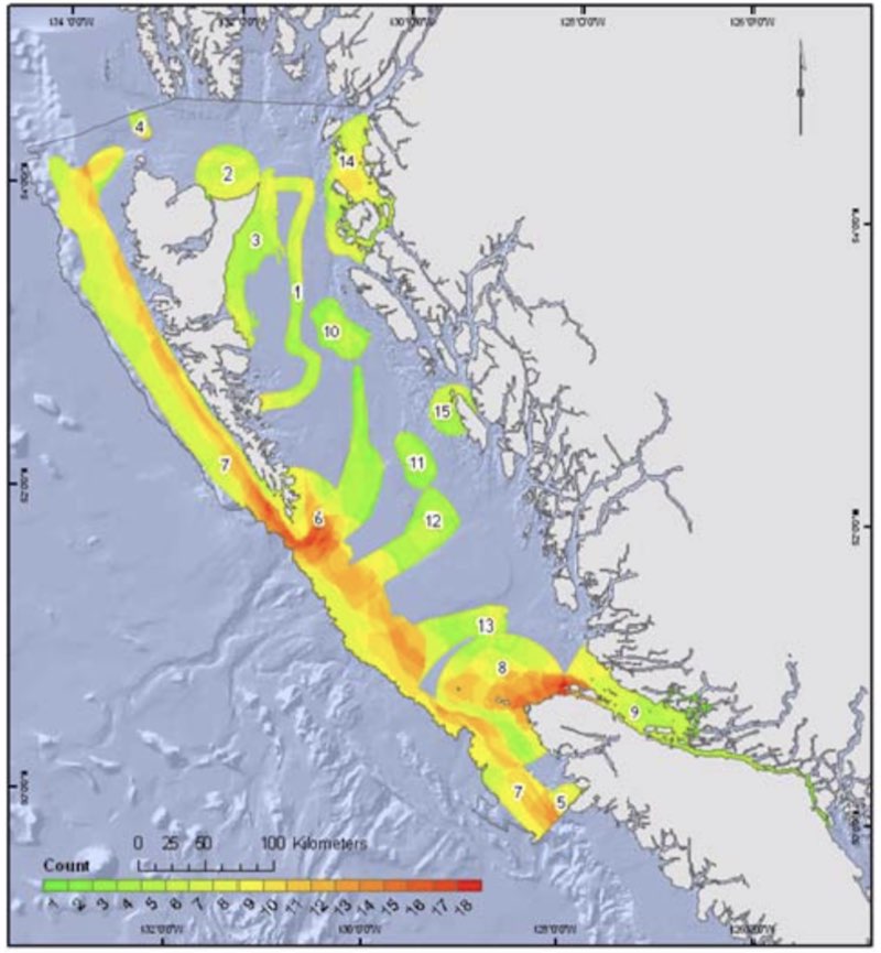
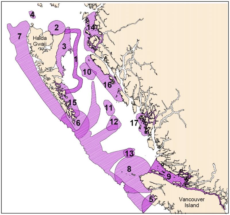
This image of the the B.C. Northern Shelf Region, displays those areas that have been identified as meeting the criteria in the form of a heat map. This heat map is a graphical representation of areas where there are high concentrations of fish (taxa: groups of one or more populations of organisms). Not surprisingly, these same areas are also of significant value to recreational, commercial, and First Nations fisheries.

Canadian Pacific EBSAs

B.C. Northern Shelf Ecoregion

B.C. Southern Shelf Ecoregion

Strait of Georgia

The current MPA process that will determine the degree to which the identified EBSAs will be protected is in the final stages of review. DFO Oceans is rushing to move ahead with finalizing the consultation phase, and to date has not held broad public consultations in communities potentially impacted by an MPA designation. Further, our sources confirm that DFO Fisheries Management—the internal DFO experts who know fishery values and are best positioned to inform the MPA process, are not invited to the MPA process.
In the rush to implement expansion of the MPA network to meet political objectives, the real risk is that areas of special significance to the recreational fishery will be closed to fishing with little regard to social and economic impacts.
Once the Northern Bioshelf Region MPA process is complete, the Oceans team will initiate an MPA process for the South Coast. Meeting a new Liberal 25% target will no doubt result in pressure to close even more areas to recreational fishing. Think about the potential consequences, and ask candidates running in this election what they will do to protect the Public Fishery and our access and opportunity to enjoy the benefits of this great fishery.
References:


This has been an extremely rushed and pointless exercise. The heat maps that were used to pick closed areas are from commercial fishing data. The model then guesses on what the features are (zero input from industry) and they produced meaningless maps. BC is already 37% protected while Atlantic Canada is at 8% and the Arctic even less. This is another Example Of how US protest dollars and screwed up Federal and Provincial policies significantly hurt small coastal communities that rely on our natural resources to survive.