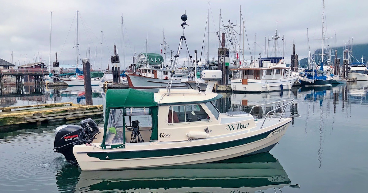
Why is Wilbur Mapping?
Part of a project called Resilient Coasts for Salmon, Wilbur helps to build a dataset of shoreline information. Wilbur records 360° video footage and high-resolution photos of the shoreline of the East Coast of Vancouver Island from Victoria up to Port McNeill.
Healthy shorelines offer habitat for an abundance of plants and animals— including forage fish like surf smelt and Pacific sand lance—that are critical food for Pacific salmon. Forage fish rely on pebble and sandy shorelines for spawning, and require healthy overhanging vegetation along the high tide line to shade their eggs.
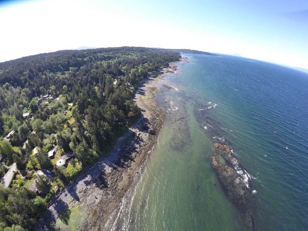
Vancouver Island BC Shoreline
Many of our shorelines have been modified with structures like seawalls, rip rap, piers, and docks which can impede natural coastal processes and degrade habitat.
Our current knowledge of the extent of coastal modification is limited, so with Wilbur’s help, we will be able to see how much of our shoreline has been modified, identify areas where there may be challenges for the salmon food web, and advocate for the use of nature-based solutions to restore key areas.
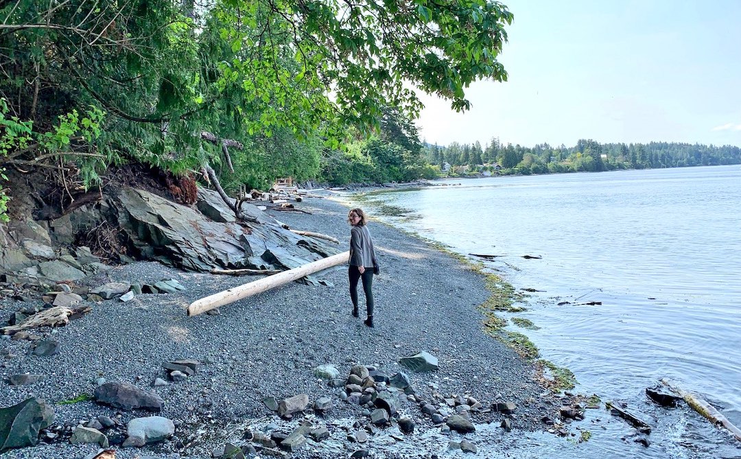
Everything that happens on the shorelines has a cascade of impacts on the health of the ecosystem. (Photo: Kyla Sheehan)
Resilient Coasts for Salmon
The Resilient Coasts for Salmon team aims to raise public awareness of the impacts of climate change and build capacity to adopt nature-based solutions along local shorelines. Program Manager Kyla Sheehan says, “The goal of the Resilient Coasts for Salmon program is to help Pacific salmon and other species adapt to climate change by preserving and restoring their natural habitat, while at the same time protecting coastal infrastructure including shoreline homes.”
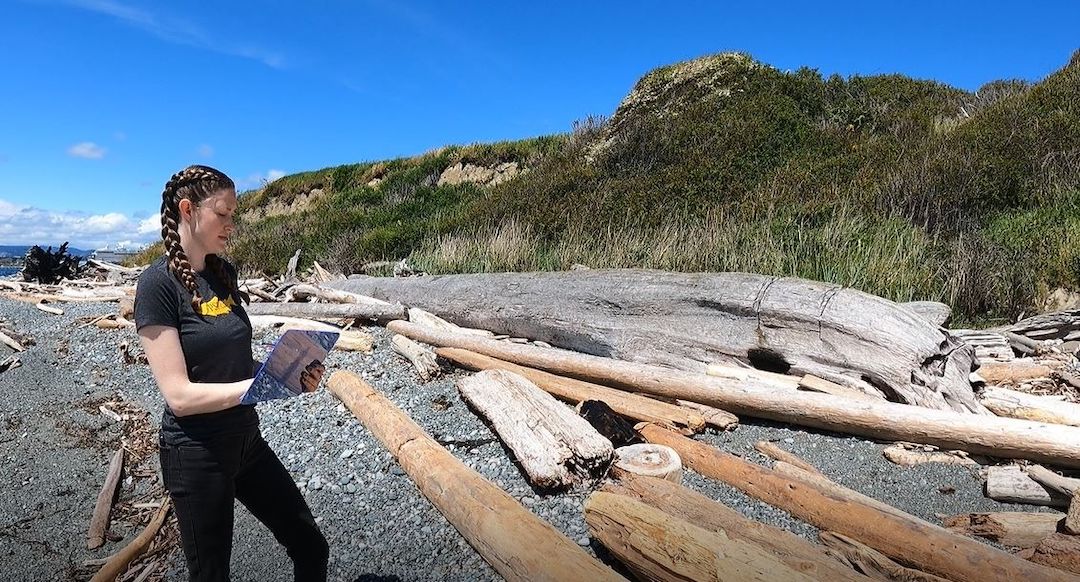
Kyla Sheehan mapping
Resilient Coasts for Salmon is a collaborative initiative led by the Pacific Salmon Foundation with partners such as the Stewardship Centre for BC, World Wildlife Fund—Canada, Peninsula Streams and Shorelines, and others. The program is funded in part by the Government of Canada.
We are all stewards of the shoreline,” says Sheehan. “Our actions, small and large, make a difference in how our shoreline ecosystems function and thrive.”
Climate Change and Costal Modification
With increased intensity and frequency of storms, coupled with rising sea levels, structures like sea walls, intended to protect coastal infrastructure, are increasingly challenged. The fallback solution is to further fortify these structures, building them bigger and stronger. Yet “hard armouring” solutions like seawalls impede natural habitat from shifting location and adjusting to changing conditions like sea-level rise.
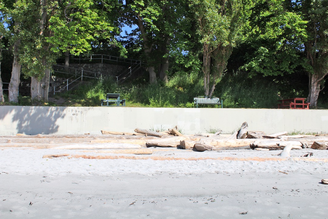
Wilbur maps shorelines modified with structures like seawalls and docks, which can impede natural coastal processes and degrade habitat. (Photo: Kyla Sheehan)
“Shorelines are dynamic in their natural state,” says Sheehan. “Yet hard-armoured structures impact coastal habitat resiliency. It’s quite a challenge for salmon.” The answer lies in adopting nature-based solutions, she says. Working with natural materials and local expertise provides cost-effective solutions for shoreline fortification while simultaneously enhancing habitat resilience.
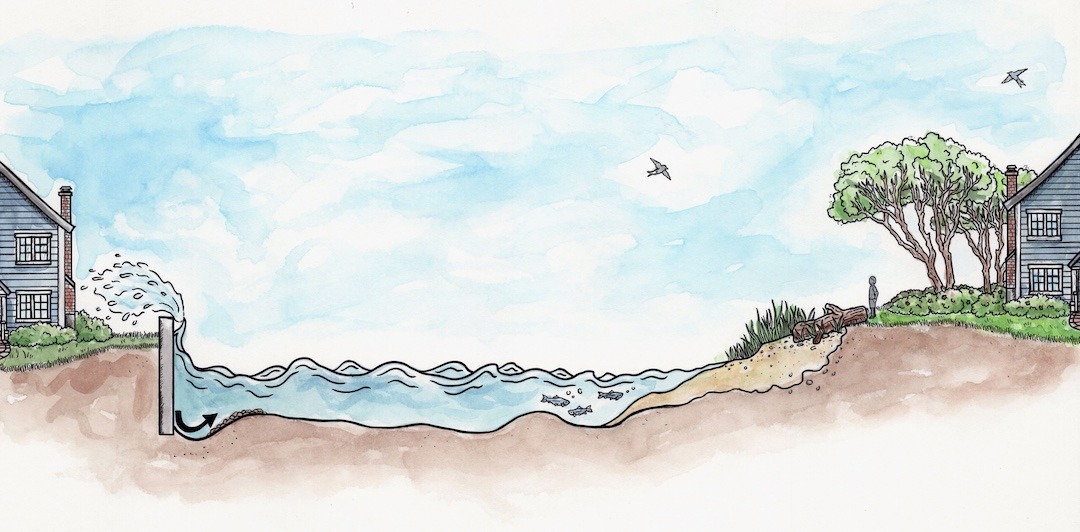
Hard structures like seawalls impede the natural shoreline from adjusting to rising tides, causing “coastal squeeze.” At right, natural shoreline leaves room for vegetation and tidal zones, preserving important habitats. (Illustration: Holly Sullivan)
With its partners, the Resilient Coasts for Salmon team is supporting Green Shores® for Shoreline Development demonstration sites at Esquimalt Gorge Park (Esquimalt), at Dyke Road Park (Comox estuary), and at Songhees Walkway Pocket Beach (north shore Middle Harbour, Victoria) to showcase how nature-based solutions work, and how they benefit high-value salmon habitat.
How Wilbur Works
On a tripod mounted above Wilbur’s cabin, an Insta360 Pro2 camera records 8K 360° video. Simultaneously, inside the 16′ C-Dory, a tripod-mounted Canon R5 still camera captures high-resolution shoreline imagery. Travelling at a speed of 9 km/hr and as close to shore as Wilbur can safely go, still images are created every three seconds.
By September 2022, Wilbur had photographed the eastern shoreline of Vancouver Island from Pedder Bay north to Schooner Cove, located just south of Parksville. In 2023, the plan is to continue capturing the eastern Vancouver Island shoreline northward from Schooner Cove to Comox.
Mapping
A great feature of Mapillary.com is that you can view multiple layers at the same time. For instance, if the same shoreline were photographed a second time, you would be able to see any changes that occurred over that time by comparing photographs.
Filmed at high tide to allow the camera to get as close to the shoreline as possible, Wilbur requires calm weather conditions to ensure the camera is steady and the pictures clear.
Linked with Wilbur’s GPS, the imagery can be mapped using track lines of the boat’s movement (see figure below), coupled with the location and view of the shoreline to mark key features observed on the shoreline.
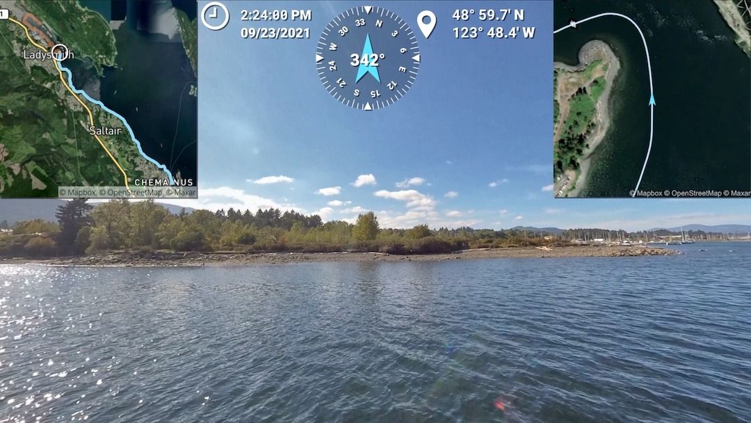
This example of Wilbur’s track lines, coupled with GPS and imagery, shows where coastal impediments to salmon and forage fish habitat occur. (Photo/image: Mitch Miller)
Using computer mapping programs, the Resilient Coasts team uses the boat- based imagery to pull out key features like shoreline modifications and digitize them into data layers. The final product will be a dataset of linear features where the shoreline is modified in a way that could impact natural coastal processes. They will describe those modification types like sea walls and boat ramps, and materials like concrete or creosote wood, for example. Once the Resilient Coasts team has reviewed the data and digitized key features within the communities of mapping workshops, they will return to host community meetings to share findings and discuss opportunities for local adaptation measures to sea-level rise.
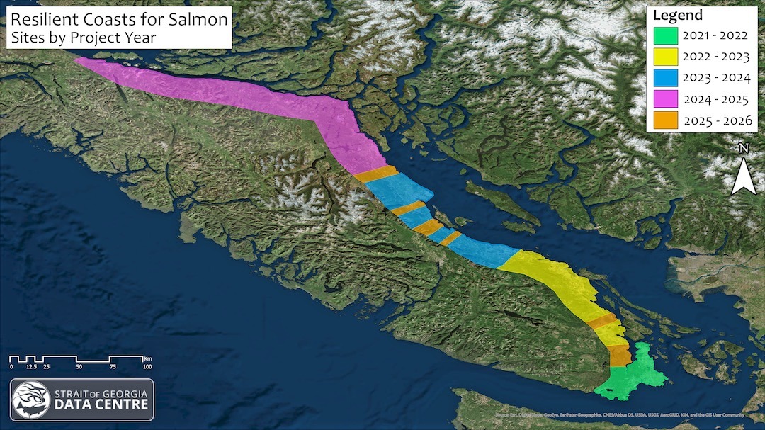
Resilient Coasts for Salmon focuses on communities along the east coast of Vancouver Island. In 2021-22 it focused on Southern Vancouver Island from Victoria to Nanaimo (green and yellow). This year the focus shifts north from Qualicum Beach to Comox (blue areas). Future years will focus on Campbell River to Port McNeill (pink) and rural areas in between (orange). (Image: Ben Skinner)
Resources For Shoreline Resiliency
Wilbur’s data will be publicly available in the Strait of Georgia Data Centre’s Marine Reference Guide. Complementary to the Mapillary.com, here you can visualize the extent of coastal modifications at local scales, and learn how this intersects with predicted sea-level rise, locations of herring and forage fish spawning habitats, and local salmon-rearing habitats. Visit the Marine Reference Guide at sogdatacentre.ca.
In addition to Wilbur’s data, the Resilient Coasts for Salmon team offers several resources ranging from an educational primer on the coastal impacts of climate change and coastal modification to a toolkit of practical tips for incorporating nature-based solutions into our daily lives.
2023 Green Shores® training sessions and shoreline mapping workshops will be held this in Qualicum, Courtenay, and Comox. Visit resilientcoasts.ca for more information.
If You See Wilbur
Be on the lookout for Wilbur as it makes its way up the coast—see if you can spot this special little research boat and wave hello or snap a photo.
If you post a photo to social media with the hashtag #PSFWilbur, the Pacific Salmon Foundation will connect and send you a gift.
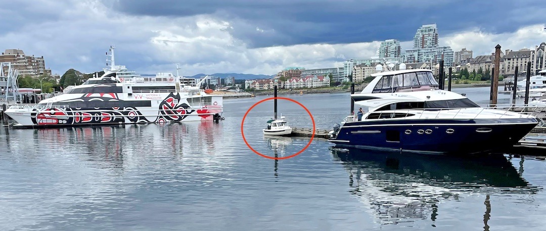
Where’s Wilbur? Right here!! Victoria Harbour #PSFWilbur
This article appeared in Island Fisherman Magazine June 2023. Never miss another issue—subscribe today!
Visit the Store
$34.99
$34.99
Featured Catch
Joel Unickow halibut (Photo: Rob Frawley Lucky Strike Sportfishing Tofino)
